Re:Thoroughfare
A Narrative on Forsaken Places
After a group survey of the urbanistic qualities of the Broadway-River Lane block (Newport, Rhode Island), this project investigates the privatization of alleyways by densely adjoined retail spaces. An urban transect was created to organize information gathered through photogrammetry and LiDAR scans. In collaboration with Leica Geosystems of Newport, documentation with their laser scanners and digital modeling software allowed us to take on this large-scale project during the beginning of the COVID-19 pandemic.
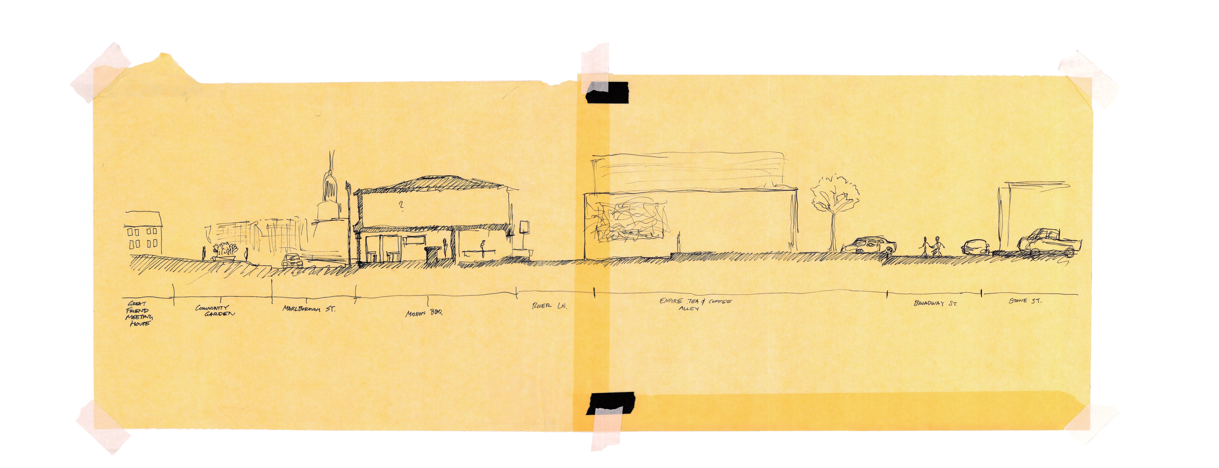
Transect AA

Leica Cyclone Point Cloud 3D Software

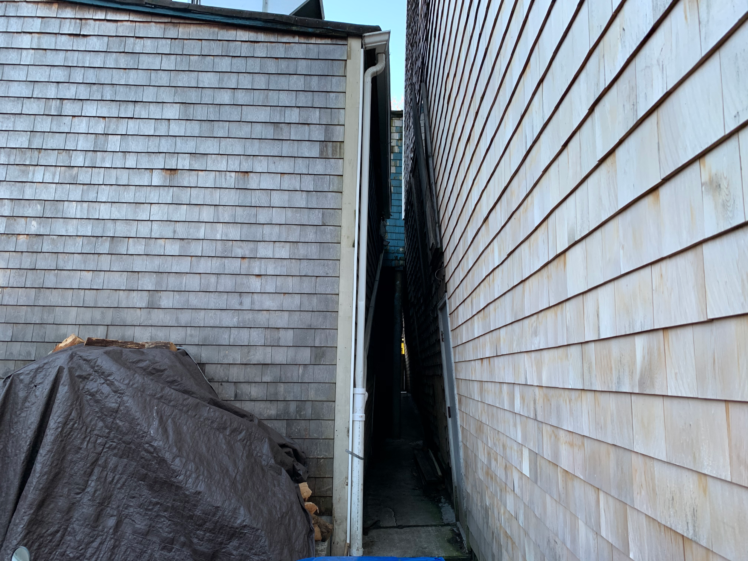

Existing Conditions
Using a Leica BLK360 compact imaging laser scanner allowed documentation in many of River Lane’s narrow alleyways.
Preliminary Transect Sketch
Intervention

This is an opportunity to showcase how food is grown, prepared, and served. Additionally, it will introduce an ethical attitude where businesses + organizations can benefit from this as a shared resource.
Due to the lack of maintenance of the privatized spaces on River Lane, it influenced my decision to revitalize the back-end operations of the retail spaces. Temporary ramps and platforms would act as an extension of the Great Friends Community Garden and three food businesses.
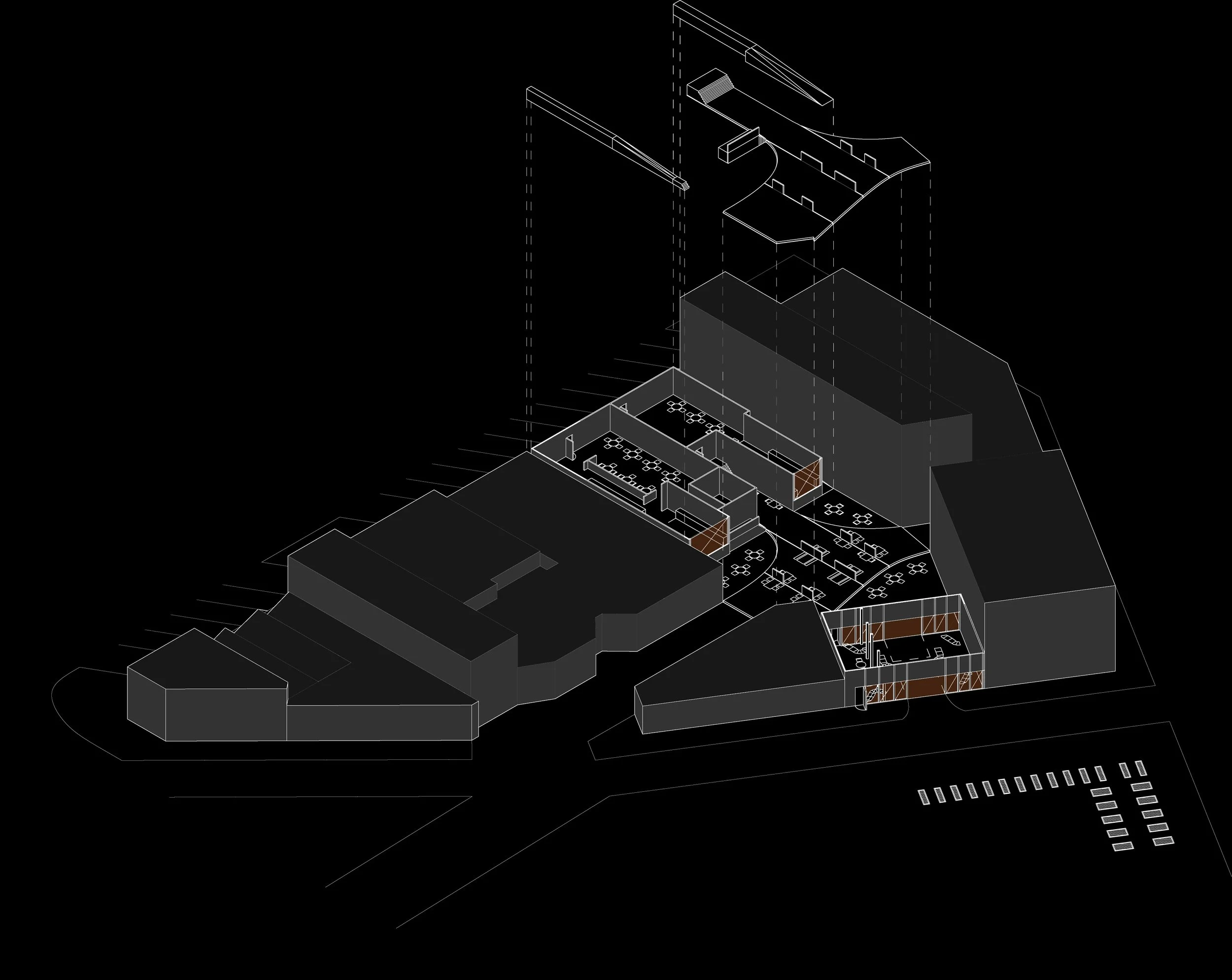
Floor Plan and Exploded Axonometric created with Adobe Illustrator + Rhinoceros 3D